

1
Open the field, then Zones
Open the field’s page, then Zones. Draw a zone draws a polygon inside the boundary. Zones from satellite proposes zones from the NDVI capture, for you to accept or discard.
2
Run the test
With two or more zones, the card Do the zones hold? appears. Run the test asks the satellite archive whether the zones have kept their order, season after season, since 2017.
3
Read the verdict
Stable means the pattern holds and the zones can carry a rate. Not stable means they describe this season rather than a pattern. Too few seasons means the archive does not yet have three clear ones.
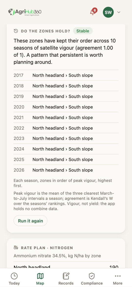
Do the zones hold? A Stable verdict over ten seasons, with each season's order.
What You See Next
A stable field can carry a rate plan and export the file for the tractor. A field that is not stable can hold a plan but cannot export it.If It Does Not
Related: Set the Rates and Export for the Tractor, Sub-field Zones, Satellite NDVI.