> ## Documentation Index
> Fetch the complete documentation index at: https://docs.agrihub360.com/llms.txt
> Use this file to discover all available pages before exploring further.
# Draw a Store, a Heap and a Ditch
> Draw a store and the nearest water, and the app measures the distance the rule requires.
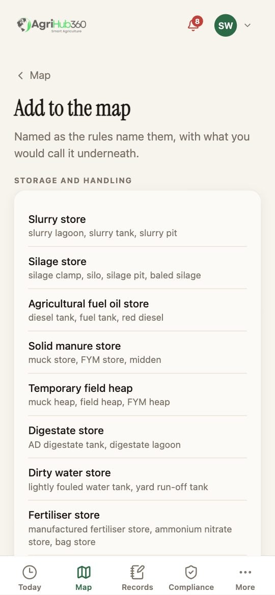
The list is named as the rules name things, with what you would call it underneath. Stores first: slurry store, silage clamp, field heap, fuel store. Then the water: watercourse, pond, spring or borehole, drain outfall.
A store is an area: tap around its edge, three points or more. A ditch is a line: tap along its length. A borehole is a point: one tap.
Give it a name. A store takes its capacity in cubic metres; a field heap takes the date it was placed, and the app works out when it must move. Then **Add to the map**.
 ## What You See Next
The siting check runs as soon as both shapes exist. A slurry store 8 m from the ditch reads "SSAFO wants 10 m, two metres short". A store with no water drawn near it shows as **unchecked** rather than compliant. The risk map in the NVZ pack draws the 10 m and 50 m strips from what you drew.
## If It Does Not
| You see | It means | Do |
| --------------------------------------- | ------------------------------------------------------ | -------------------------------------------------- |
| The store says unchecked | No watercourse, pond or borehole is drawn within reach | Draw the nearest water, or note that there is none |
| A heap shows a move-by date in the past | It has been on that site over twelve months | Move it and add the new site with today's date |
| The ditch is piped for that length | The rule measures to open water | Say so in the feature's notes and keep a photo |
Related: [Farm Map and Siting Checks](/features/farm-management/farm-map-and-siting-checks), [Read the Inspection List and Fix a Line](/how-do-i/compliance/read-the-inspection-list-and-fix-a-line).
## What You See Next
The siting check runs as soon as both shapes exist. A slurry store 8 m from the ditch reads "SSAFO wants 10 m, two metres short". A store with no water drawn near it shows as **unchecked** rather than compliant. The risk map in the NVZ pack draws the 10 m and 50 m strips from what you drew.
## If It Does Not
| You see | It means | Do |
| --------------------------------------- | ------------------------------------------------------ | -------------------------------------------------- |
| The store says unchecked | No watercourse, pond or borehole is drawn within reach | Draw the nearest water, or note that there is none |
| A heap shows a move-by date in the past | It has been on that site over twelve months | Move it and add the new site with today's date |
| The ditch is piped for that length | The rule measures to open water | Say so in the feature's notes and keep a photo |
Related: [Farm Map and Siting Checks](/features/farm-management/farm-map-and-siting-checks), [Read the Inspection List and Fix a Line](/how-do-i/compliance/read-the-inspection-list-and-fix-a-line).