> ## Documentation Index
> Fetch the complete documentation index at: https://docs.agrihub360.com/llms.txt
> Use this file to discover all available pages before exploring further.
# Draw a Field
> Draw a field with a few taps on the map and give it a name. The area is worked out for you.
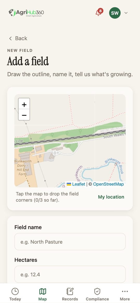
**Add a field** under the map offers three doors; **Draw one field** opens the map around the phone. **My location** recentres it.
Tap the map at each corner of the field, three or more. The hectares appear as you go. Tap a dot to remove it; **Clear** starts again.
Type the **Field name** and pick the crop. Hectares are filled in from the outline; change them if the mapped figure is wrong. Then **Save field**.
 ## What You See Next
The field is on the Map in its crop colour and on Today the moment a rule applies to it. A field with a crop feeds the nutrient plan and the closed periods. If you have the RPA file, [Upload the RPA File](/how-do-i/map/upload-the-rpa-file) draws every field at once.
## If It Does Not
| You see | It means | Do |
| ----------------------------- | ------------------------------------ | ---------------------------------------------------------- |
| The map is on the wrong place | Location is off on the phone | Pan to the farm, or allow location and tap **My location** |
| Save field is greyed | Fewer than three corners, or no name | Add a corner; type the name |
| The hectares look wrong | A corner is off | Tap the dot to remove it and tap again |
Related: [Upload the RPA File](/how-do-i/map/upload-the-rpa-file), [Switch the Layers](/how-do-i/map/switch-the-layers), [Field Map First](/features/field-monitoring/field-map-first).
## What You See Next
The field is on the Map in its crop colour and on Today the moment a rule applies to it. A field with a crop feeds the nutrient plan and the closed periods. If you have the RPA file, [Upload the RPA File](/how-do-i/map/upload-the-rpa-file) draws every field at once.
## If It Does Not
| You see | It means | Do |
| ----------------------------- | ------------------------------------ | ---------------------------------------------------------- |
| The map is on the wrong place | Location is off on the phone | Pan to the farm, or allow location and tap **My location** |
| Save field is greyed | Fewer than three corners, or no name | Add a corner; type the name |
| The hectares look wrong | A corner is off | Tap the dot to remove it and tap again |
Related: [Upload the RPA File](/how-do-i/map/upload-the-rpa-file), [Switch the Layers](/how-do-i/map/switch-the-layers), [Field Map First](/features/field-monitoring/field-map-first).